In Depth
The place is also associated with names such as Panimur and Koka Hills in different travel references. This variation in naming can sometimes cause confusion when searching for directions, so it is useful to identify Amreng Tourist Centre and the river confluence when planning your journey.
Natural Beauty and the River Confluence
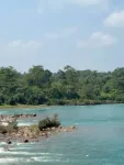
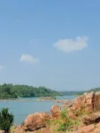
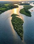
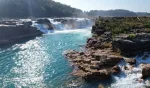
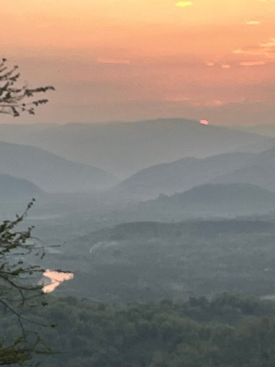
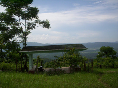
The main attraction of Amreng is its striking landscape, where flowing river water passes through rocky riverbeds beneath green hills and evergreen forest. The meeting of the Kapili and Amreng rivers creates a picturesque setting for photography, relaxing by the water and enjoying the open scenery. During the cooler months, the hills and surrounding vegetation offer a particularly pleasant backdrop.
The exposed rocks and changing river channels are among the area's defining features. Visitors can enjoy riverside walks and spend time observing the landscape, but should be careful near the water. River conditions can change quickly, especially during and after heavy rainfall.
Things to See and Do at Amreng
Kapili-Amreng River Confluence: Spend time near the meeting point of the two rivers and enjoy the views of the water, rocky banks and surrounding hills. It is the central attraction of the Amreng experience.
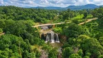
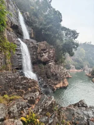
Dinar Falls: Explore Dinar Falls, a nearby natural attraction associated with the Amreng area. The waterfall and its green surroundings can add a nature-exploration stop to a longer visit. Check the local approach and access conditions before travelling.
Koka Picnic Spot and Panimur: The wider Koka and Panimur area is known for its rocky river scenery and picnic locations. Travellers should confirm local routes and place names, as these names are sometimes used interchangeably in travel references.
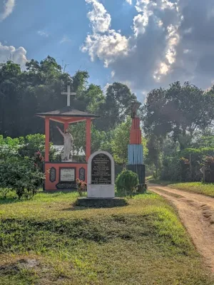
Lower Koka (Karchak): Lower Koka is noted for a historic British-era bridge and its surrounding natural landscape. It offers an additional point of interest for visitors exploring the area beyond the main riverbank.
Boating and Outdoor Activities: Boating may be available seasonally, depending on local arrangements and river conditions. The landscape is also suitable for photography, birdwatching, nature walks and short hikes. Always follow local safety guidance and do not enter the river during strong currents or rising water.
Karbi Culture and Local Experiences
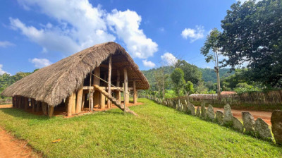
Amreng lies within the culturally rich Karbi region of Assam. A visit can be an opportunity to learn about local village life, traditional food, crafts and the customs of indigenous communities. Karbi festivals and cultural gatherings are important parts of the region's identity. Visitors may also explore the wider West Karbi Anglong landscape and nearby Hill Tiwa settlements around Umswai Valley, where distinctive village traditions and community practices continue.
If visiting a village or attending a local event, ask permission before photographing residents, homes, ceremonies or culturally important places. Supporting local guides and small businesses can also help contribute to community-based tourism.
Nearby Places to Explore
Amreng can be included in a wider West Karbi Anglong itinerary rather than treated only as a single picnic stop. Depending on road conditions and available time, visitors may consider combining the trip with Koka Picnic Spot, Dinar Falls, Lower Koka and destinations around Umswai Valley. Shikdamakha and other Hill Tiwa villages in the valley offer a different cultural experience from the riverside landscape.
These places are spread across a broad area, so check distances and travel times locally before attempting to cover several stops in one day.
Best Time to Visit Amreng
November to February is generally a comfortable period for visiting Amreng. The cooler, drier weather is suitable for riverside picnics, photography and exploring nearby attractions. March may also be suitable, depending on temperatures and local conditions.
The monsoon season brings heavier rainfall and can increase the flow of the Kapili and Amreng rivers. Although the surrounding greenery becomes especially attractive, high water levels, slippery rocks and sudden changes in river conditions can make outdoor activities unsafe. Avoid standing on exposed rocks near fast-flowing water and follow local advice.
How to Reach Amreng from Guwahati
By Road: Guwahati is a major starting point for a road journey to Amreng. The distance varies across route references, with estimates ranging from approximately 172 km to 249 km depending on the route and starting point. Travellers should check a current navigation route before departure. Lanka is a useful approach town, around 30-34 km from Amreng according to the supplied references. From Lanka, continue towards the Amreng area using a private vehicle or locally arranged taxi. Hamren is another regional reference point, approximately 80 km away.
By Train: Lanka Railway Station is commonly identified as the nearest railway station, approximately 30-34 km from the tourist centre. Hojai Railway Station is another possible railhead, depending on the route. From either station, arrange a local taxi or private vehicle for the onward journey.
By Air: Salonibari Airport near Tezpur is listed in the supplied references at approximately 134 km. Guwahati's Lokpriya Gopinath Bordoloi International Airport is another major option, although the road journey from there is longer. Airport choice should be based on available flights and the actual route to Amreng.
Local Transport: Public transport may be limited for the final stretch to the riverside location. Hiring a vehicle from Lanka, Hojai or another nearby town is a practical option. If travelling in a group, arranging the return journey in advance is recommended.
Where to Stay in Amreng
The main accommodation option mentioned for the destination is a government-run tourist lodge situated near the riverbank. It offers a basic stay for visitors who want to spend more time in the natural surroundings. Room availability, facilities, booking arrangements and current operating status should be confirmed before travelling.
Another option mentioned in the area is Karbi Langpi Resort, also associated with the Green Nest Resort and Power House area.
Karbi Langpi Resort / Green Nest Resort
Address: Rok Langso, Amtereng, in front of Karbi Langpi Hydro Electric Project, P.O. Baithalangso, West Karbi Anglong, Assam - 782450
General enquiries: +91 91014 08374
Longjut online booking: +91 88226 08408
For the government tourist lodge and tourism-related enquiries, the following contact numbers were provided in the reference information:
Office: +91 9365300711
Shri Mirjeng Ronghang, Deputy Director of Tourism: +91 7002756771
Please confirm that these numbers are current and that the accommodation is accepting bookings before making travel arrangements. Visitors who prefer more hotel choices can consider staying in Lanka or Hamren and visiting Amreng as a day trip.
Travel Tips for Visitors
Carry enough cash, as card payment facilities and ATMs may not be available at the riverside site.
Bring drinking water, snacks and any essential medicines.
Wear footwear with a good grip, especially when walking over rocks.
Check river levels and weather conditions before visiting.
Do not swim or go boating unless local operators confirm that conditions are safe.
Arrange local transport and accommodation in advance.
Keep the riverbank clean and avoid disturbing wildlife or the natural environment.
Experience the Natural Charm of West Karbi Anglong
Amreng offers a different kind of Assam travel experience, combining a beautiful river confluence, forested hills, local culture and opportunities for outdoor exploration. Whether you are planning a family picnic, a photography trip or a longer journey through West Karbi Anglong, the destination provides a chance to enjoy the quieter landscapes of Assam. Exploring nearby waterfalls, historic sites and traditional villages can make the visit even more rewarding.
Quick information about Amreng
| Particulars | Details |
|---|---|
| Tourist Place | Amreng Tourist Centre |
| Location | West Karbi Anglong, Assam |
| Also Known As | Panimur, Koka Hills (names used in some references) |
| Main Attraction | Confluence of the Kapili and Amreng rivers |
| Nearby Attractions | Dinar Falls, Koka Picnic Spot, Lower Koka (Karchak) |
| Nearest Town / Railhead | Lanka |
| Distance from Lanka | Approximately 30-34 km |
| Distance from Hamren | Approximately 80 km |
| Distance from Diphu | Approximately 120 km (route-dependent) |
| Distance from Guwahati | Approximately 172-249 km (route-dependent) |
| Nearest Railway Station | Lanka Railway Station |
| Other Railway Option | Hojai Railway Station |
| Nearby Airport | Salonibari Airport, Tezpur (reported around 134 km) |
| Best Time to Visit | November to February |
| Activities | Riverside picnics, photography, nature walks, seasonal boating and birdwatching |
| Accommodation | Government tourist lodge and Karbi Langpi Resort (confirm availability) |
| Local Tourism Contact | +91 9365300711 |
| Deputy Director of Tourism | Shri Mirjeng Ronghang - +91 7002756771 |
| Karbi Langpi Resort | +91 91014 08374 |
| Longjut Online Booking | +91 88226 08408 |
Frequently asked questions about Amreng
1. Where is Amreng Tourist Centre located?
Amreng Tourist Centre is situated in West Karbi Anglong district of Assam, near the confluence of the Kapili and Amreng rivers. It is a popular riverside destination known for its scenic hills, rocky riverbanks and natural surroundings.
2. Why is Amreng called the Switzerland of Assam?
Amreng is often described as the Switzerland of Assam because of its green hills, forest-covered landscape, clear river stretches and attractive rocky formations. The combination of hills and rivers gives the area a distinctive scenic appearance.
3. Which rivers meet at Amreng?
The Kapili River and its tributary, the Amreng River, meet in the Amreng area. Their confluence is the main natural attraction and provides beautiful views for photography and riverside visits.
4. How far is Amreng from Guwahati?
The road distance from Guwahati is reported to range from approximately 172 km to 249 km, depending on the route and starting point. Check current navigation directions before travelling because road conditions and route choices can affect the journey.
5. What is the nearest railway station to Amreng?
Lanka Railway Station is commonly listed as the nearest railway station, approximately 30-34 km from Amreng. Hojai Railway Station may also be considered depending on the route. Local taxis or private vehicles are needed for the onward journey.
6. What is the best time to visit Amreng?
November to February is generally considered a suitable time to visit because of the cooler weather and more comfortable conditions for picnics and outdoor activities. Monsoon brings greener scenery and stronger river flow, but can also make the area unsafe due to rising water levels.
7. What are the main attractions near Amreng?
The main attractions include the Kapili-Amreng river confluence, Dinar Falls, Koka Picnic Spot and Lower Koka (Karchak), which is associated with a British-era bridge. Visitors can also explore the wider Umswai Valley region if they have additional time.
8. Are accommodation facilities available at Amreng?
A government-run tourist lodge is reported to be available near the riverbank. Karbi Langpi Resort is another accommodation option mentioned in the area. Contact the properties or the local tourism office to confirm current availability, facilities and booking procedures.
9. What activities can visitors enjoy at Amreng?
Visitors can enjoy riverside picnics, photography, nature walks, birdwatching and short hikes. Seasonal boating or angling may be possible where locally permitted. Activities in or around the river should always depend on water levels and local safety advice.
10. Is Amreng suitable for a family trip?
Yes, Amreng can be a pleasant destination for a family outing, especially during the cooler and drier months. Families should supervise children near the river, avoid slippery rocks and fast-flowing water, and carry food, drinking water and other essentials because facilities may be limited.